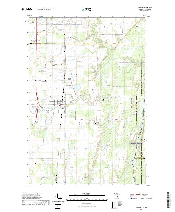
2022 Map of Rush City
USGS Topo · Published 2022About this map
Rush City serves as the central hub of this northern Chisago County landscape, situated along the Interstate 35 corridor as it moves toward the Pine County line. The settlement pattern is defined by a grid of agricultural roads and drainage systems, including County Ditch Number Six and County Ditch Number Nine, which facilitate the region's productive farmland. The eastern edge of the quadrangle is marked by the Saint Croix National Scenic Riverway, where the Minnesota-Wisconsin border follows the river's winding course.
Find a feature on this map
58 named features on this map. Tap any name to fly to it.
Don’t see what you’re looking for? This feature index may not catch every label — zoom into the map to look around manually.
Map Details
Editions of this 2022 Rush City Map
This is the sole edition of this map. No revisions or reprints were ever made.
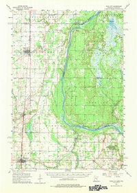
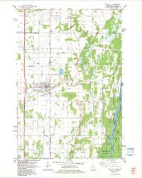
Historical Maps of Anderson Through Time
4 maps found