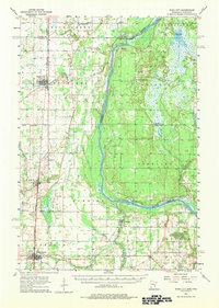
1955 Map of Rush City
USGS Topo · Published 1983About this map
Rush City and the neighboring settlements of Harris and North Branch center this 1955 mid-century landscape along the border of Minnesota and Wisconsin. The area's cultural heritage is deeply imprinted on the land through numerous denominational and community burial grounds, such as the Swedish Cem, Covenant Cem, and Indian Cem. These sites, alongside landmarks like Pleasant Prairie Ch, reflect the ethnic and social foundations of the St. Croix Valley's rural townships.
Find a feature on this map
51 named features on this map. Tap any name to fly to it.
Don’t see what you’re looking for? This feature index may not catch every label — zoom into the map to look around manually.
Map Details
Editions of this 1955 Rush City Map
5 editions found
Other maps of this area

1900 · St Croix Dalles
USGS Topo · 1:62,500

1901 · St Croix Dalles
USGS Topo · 1:62,500

1950 · Rush City
USGS Topo · 1:48,000

1950 · Grantsburg
USGS Topo · 1:48,000

1951 · Milltown
USGS Topo · 1:48,000

1953 · Stillwater
USGS Topo · 1:250,000

1955 · St. Croix Dalles
USGS Topo · 1:62,500

1955 · Rush City
USGS Topo · 1:62,500

1955 · Milltown
USGS Topo · 1:62,500

1955 · Forest Lake
USGS Topo · 1:62,500