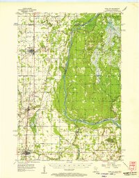
1955 Map of Rush City
USGS Topo · Published 1957About this map
The St Croix River serves as the central artery and natural boundary of this mid-century landscape, separating the agricultural plains of Minnesota from the wooded marshes of Wisconsin. The Northern Pacific railroad corridor anchors the western settlements, connecting Rush City and North Branch through a network of family-centered landmarks and community sites. Traces of early infrastructure are visible in the Old Railroad Grade north of Goose Creek, while the presence of the Sterling Lookout Tower and a Gaging Station on the river reflect the era’s focus on resource management and fire prevention.
Find a feature on this map
44 named features on this map. Tap any name to fly to it.
Don’t see what you’re looking for? This feature index may not catch every label — zoom into the map to look around manually.
Map Details
Editions of this 1955 Rush City Map
5 editions found
Other maps of this area

1900 · St Croix Dalles
USGS Topo · 1:62,500

1901 · St Croix Dalles
USGS Topo · 1:62,500

1950 · Rush City
USGS Topo · 1:48,000

1950 · Grantsburg
USGS Topo · 1:48,000

1951 · Milltown
USGS Topo · 1:48,000

1953 · Stillwater
USGS Topo · 1:250,000

1955 · St. Croix Dalles
USGS Topo · 1:62,500

1955 · Rush City
USGS Topo · 1:62,500

1955 · Milltown
USGS Topo · 1:62,500

1955 · Forest Lake
USGS Topo · 1:62,500