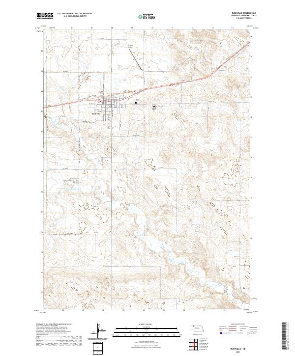
2021 Map of Rushville
USGS Topo · Published 2021About this map
Rushville serves as the seat of local government, anchored by the Sheridan County Courthouse and a grid of residential streets including Chamberlain St and Loofborrow St. The town is a focal point of infrastructure in the High Plains, where the Cowboy Trl follows the former railroad corridor through the center of the community. Local history is preserved at Saint Marys Cem and Fair View Cem, located just east of the main settlement. The surrounding landscape is defined by the drainage of Rush Cr and Hay Springs Cr, showcasing the typical agricultural and ranching patterns of northwestern Nebraska. To the north, Modisett Airport provides a modern link to this largely rural region, which remains characterized by its section-line roads like 610th Rd and 330th Ln.
Find a feature on this map
47 named features on this map. Tap any name to fly to it.
Don’t see what you’re looking for? This feature index may not catch every label — zoom into the map to look around manually.
Map Details
Editions of this 2021 Rushville Map
This is the sole edition of this map. No revisions or reprints were ever made.
Other maps of this area

1955 · Alliance
USGS Topo · 1:250,000

1957 · Alliance
USGS Topo · 1:250,000

1958 · Alliance
USGS Topo · 1:250,000

1960 · Hay Springs SE
USGS Topo · 1:24,000

1966 · Rushville
USGS Topo · 1:24,000

1966 · Rushville SW
USGS Topo · 1:24,000

1966 · Hay Springs NE
USGS Topo · 1:24,000

1969 · Clinton
USGS Topo · 1:24,000

1969 · Clinton SW
USGS Topo · 1:24,000

1969 · Rushville SE
USGS Topo · 1:24,000