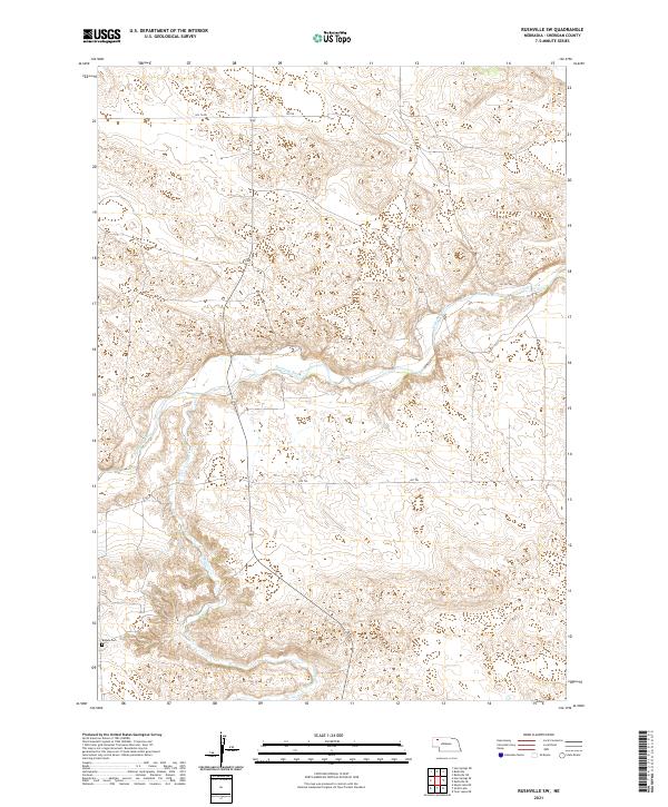
2021 Map of Rushville SW
USGS Topo · Published 2021About this map
The Niobrara River carves a central path through this Sheridan County landscape, defining the topography of the Nebraska Sandhills. In the southwest corner, Begun Cem serves as a lone marker of local family history and settlement along the northern plains. The terrain is characterized by complex drainage patterns, where Pine Cr flows northward to meet the river. A network of rural routes, including 520 Th Rd, 470 Trl, and 292 Nd Trl, provides access across the townships of this section of the state, revealing how the modern transportation grid follows the natural contours of the river valley.
Find a feature on this map
13 named features on this map. Tap any name to fly to it.
Don’t see what you’re looking for? This feature index may not catch every label — zoom into the map to look around manually.
Map Details
Editions of this 2021 Rushville SW Map
This is the sole edition of this map. No revisions or reprints were ever made.
Other maps of this area

1948 · Twin Lakes
USGS Topo · 1:62,500

1950 · Twin Lakes
USGS Topo · 1:62,500

1950 · Skunk Lake
USGS Topo · 1:62,500

1955 · Alliance
USGS Topo · 1:250,000

1957 · Alliance
USGS Topo · 1:250,000

1958 · Alliance
USGS Topo · 1:250,000

1960 · Hay Springs SE
USGS Topo · 1:24,000

1966 · Rushville
USGS Topo · 1:24,000

1966 · Rushville SW
USGS Topo · 1:24,000

1966 · Hay Springs NE
USGS Topo · 1:24,000