2024 Map of Rutland
USGS Topo · Published 2024About this map
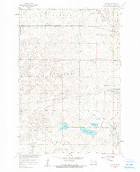
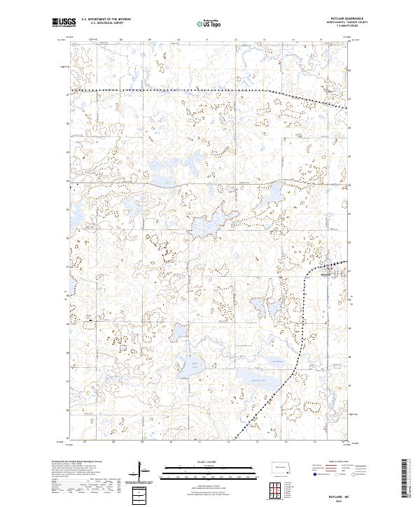
Rutland sits at the intersection of a vast wetland conservation network in the southeastern corner of Sargent County. This landscape is defined by the extensive protected lands of the Tewaukon National Wildlife Refuge and the Sargent County Waterfowl Production Area, which surround a series of glacial lakes and prairie potholes. The Wild Rice River meanders through the southern portion of the quadrangle, feeding into Sprague Lake and Lake Mann. To the west of the settlement, Trinity Cem remains a significant landmark for those tracing local family histories. The rigid grid of section roads, including Co Rd 3 and 138th Ave SE, highlights the tension between agricultural development and the preservation of the region's aquatic ecosystems, such as Silver Lake and Crooked Creek.
Find a feature on this map
33 named features on this map. Tap any name to fly to it.
Don’t see what you’re looking for? This feature index may not catch every label — zoom into the map to look around manually.
Map Details
Editions of this 2024 Rutland Map
This is the sole edition of this map. No revisions or reprints were ever made.