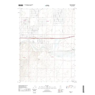
2018 Map of Ryndon
USGS Topo · Published 2018About this map
The Humboldt River and its North Fork dominate this Elko County landscape, where the settlements of Ryndon and Elburz sit along the river's path. The map illustrates a transition from the riparian corridor to significant high-relief terrain, notably Elko Mtn and East Peak. The area is characterized by a mix of early-established ranching interests and a modern residential grid, evidenced by the dense network of named streets like Taft Dr and Coal Mine Rd north of the interstate. Local hydrology is further defined by Sustacha Spring and Coal Mine Cr, while prominent landforms such as Osino Canyon and the Peko Hills provide natural boundaries to the developed corridors. This 2018 survey detail provides a look at the infrastructure of the South Fork Valley region as it stood in the late 2010s.
Find a feature on this map
73 named features on this map. Tap any name to fly to it.
Don’t see what you’re looking for? This feature index may not catch every label — zoom into the map to look around manually.
Map Details
Editions of this 2018 Ryndon Map
This is the sole edition of this map. No revisions or reprints were ever made.
Other maps of this area

1935 · Halleck
USGS Topo · 1:125,000

1955 · Wells
USGS Topo · 1:250,000

1955 · Elko
USGS Topo · 1:250,000

1957 · Elko East
USGS Topo · 1:24,000

1958 · Wells
USGS Topo · 1:250,000

1958 · Elko
USGS Topo · 1:250,000

1961 · Wells
USGS Topo · 1:250,000

1962 · Elko
USGS Topo · 1:250,000

1962 · Boyd Reservoir
USGS Topo · 1:24,000

1962 · Ryndon
USGS Topo · 1:24,000