
1958 Map of Elko
USGS Topo · Published 1958About this map
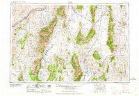
The Humboldt River and its various forks anchor this high-desert region, where mid-century transportation routes followed the natural corridors of the Adobe Range and Ruby Mountains. Around the hub of Elko, the map reveals a landscape defined by the parallel infrastructure of the Southern Pacific and Western Pacific railroads. The eastern portion is dominated by military and aviation history, notably the Wendover Air Force Base and the extensive Wendover Bombing and Gunnery Range stretching toward the Barren Desert. Settlement is sparse outside of established ranching and rail stops like Halleck and Shafter, while the southern reaches preserve significant wetlands at the Ruby Lake National Wildlife Refuge. Industrial traces are marked by the Victoria Mine and Spruce Mountain Mine, reflecting the area's mineral foundations.
Find a feature on this map
69 named features on this map. Tap any name to fly to it.
Don’t see what you’re looking for? This feature index may not catch every label — zoom into the map to look around manually.
Map Details
Editions of this 1958 Elko Map
2 editions found
Other maps of this area

1908 · Fish Springs
USGS Topo · 1:250,000

1910 · Fish Springs
USGS Topo · 1:250,000

1925 · Gold Hill
USGS Topo · 1:62,500

1926 · Roberts Mountains
USGS Topo · 1:250,000

1928 · Gold Hill
USGS Topo · 1:62,500

1929 · Roberts Mountains
USGS Topo · 1:250,000

1934 · Jiggs
USGS Topo · 1:125,000

1935 · Halleck
USGS Topo · 1:125,000

1937 · Mineral Hill
USGS Topo · 1:48,000

1937 · Jiggs
USGS Topo · 1:125,000