Loading...
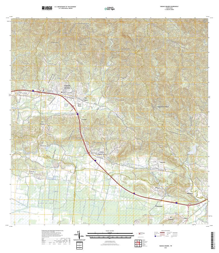
Loading map...2024 Map of Sabana Grande
USGS Topo · Published 2024About this map
Sabana Grande sits at the heart of this topographic landscape, where the foothills meet the expansive Valle de Lajas. The town center is defined by local civic landmarks like the Tribunal de Sabana Grande and the Cementerio Municipal Sabana Grande, while the surrounding countryside is dotted with residential sectors such as San Isidro, Santa Maria, and Liborio Negrón Torres.
Find a feature on this map
60 named features on this map. Tap any name to fly to it.
Don’t see what you’re looking for? This feature index may not catch every label — zoom into the map to look around manually.
Map Details
Date Portrayed2024
Date Published2024
PublisherU.S. Geological Survey
Map TypeTopographic
Scale1:20000
Physical Dimensions29 x 33.5 inches
Editions of this 2024 Sabana Grande Map
This is the sole edition of this map. No revisions or reprints were ever made.
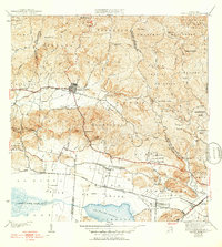
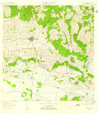
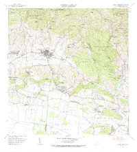
Historical Maps of Sector Los Berrocales Through Time
5 maps found

Featured Locations
- Sabana Grande, Sabana Grande
- Villa Juanita, San Germán
- Sector Los Berrocales, Yauco
- Sector Palmas Gordas, Yauco
- Sector El Túnel, Yauco
Source Details
SourceU.S. Geological Survey
CopyrightPublic Domain