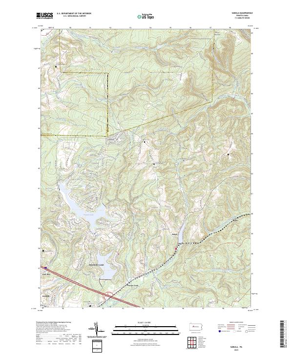
2023 Map of Sabula
USGS Topo · Published 2023About this map
Treasure Lake and its intricate network of surrounding residential roads dominate the lower-left quadrant of this topographic survey, illustrating the late-20th-century development of this recreational and residential community. The landscape is defined by the high ridges of Boone Mountain and the deep drainage patterns of the Bennett Branch Sinnemahoning Creek and Sandy Lick Creek. These watercourses carve through a terrain that marks the intersection of Clearfield, Elk, and Jefferson counties.
Find a feature on this map
153 named features on this map. Tap any name to fly to it.
Don’t see what you’re looking for? This feature index may not catch every label — zoom into the map to look around manually.
Map Details
Editions of this 2023 Sabula Map
This is the sole edition of this map. No revisions or reprints were ever made.
Other maps of this area

1922 · Du Bois
USGS Topo · 1:62,500

1924 · Du Bois
USGS Topo · 1:62,500

1929 · Penfield
USGS Topo · 1:62,500

1932 · Penfield
USGS Topo · 1:62,500

1940 · Hallton
USGS Topo · 1:48,000

1941 · Ridgway
USGS Topo · 1:62,500

1943 · Hallton
USGS Topo · 1:62,500

1944 · Du Bois
USGS Topo · 1:62,500

1944 · Ridgway
USGS Topo · 1:62,500

1957 · Warren
USGS Topo · 1:250,000