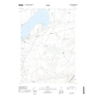
2019 Map of Sackets Harbor
USGS Topo · Published 2019About this map
Lake Ontario dominates the northwestern portion of this coastal landscape, where Black River Bay and the Black River Channel meet the rocky shoreline at Pillar Point and Navy Point. This modern survey illustrates the strategic and maritime importance of Sackets Harbor, a location long-defined by its protected waters and military heritage. Inland, the map reveals a transition to rural agricultural land and wetlands, notably the Beaver Meadows and the meandering course of Muskellunge Creek.
Find a feature on this map
94 named features on this map. Tap any name to fly to it.
Don’t see what you’re looking for? This feature index may not catch every label — zoom into the map to look around manually.
Map Details
Editions of this 2019 Sackets Harbor Map
This is the sole edition of this map. No revisions or reprints were ever made.
Other maps of this area

1893 · Sackets Harbor
USGS Topo · 1:62,500

1895 · Sacketts Harbor
USGS Topo · 1:62,500

1895 · Watertown
USGS Topo · 1:62,500

1898 · Watertown
USGS Topo · 1:62,500

1900 · Clayton
USGS Topo · 1:62,500

1903 · Clayton
USGS Topo · 1:62,500

1903 · Theresa
USGS Topo · 1:62,500

1908 · Watertown
USGS Topo · 1:62,500

1909 · Watertown
USGS Topo · 1:62,500

1942 · Henderson Bay
USGS Topo · 1:31,680