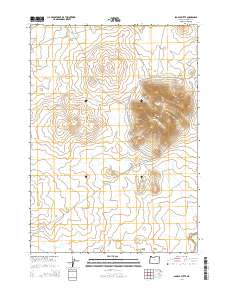
2014 Map of Saddle Butte
USGS Topo · Published 2014About this map
Saddle Butte rises as the central volcanic landmark of this high-desert landscape in Malheur County. The map details the expansive Saddle Butte Lava Field, illustrating the geological footprint of past volcanic activity across the high plateau. The topography is defined by the prominent Saddle Butte Spur, which stretches northwest from the main peak. This 2014 survey documents a land of intermittent drainage, where Ryegrass Cr and Bull Cr provide the primary hydrologic features in an otherwise arid environment. The map is largely dominated by public land divisions, showing the precise survey lines of T28S, T29S, and T30S R39E, reflecting the organized management of the Oregon interior.
Find a feature on this map
11 named features on this map. Tap any name to fly to it.
Don’t see what you’re looking for? This feature index may not catch every label — zoom into the map to look around manually.
Map Details
Editions of this 2014 Saddle Butte Map
This is the sole edition of this map. No revisions or reprints were ever made.
Other maps of this area

1955 · Jordan Valley
USGS Topo · 1:250,000

1955 · Burns
USGS Topo · 1:250,000

1955 · Adel
USGS Topo · 1:250,000

1955 · Boise
USGS Topo · 1:250,000

1957 · Adel
USGS Topo · 1:250,000

1957 · Jordan Valley
USGS Topo · 1:250,000

1958 · Burns
USGS Topo · 1:250,000

1958 · Boise
USGS Topo · 1:250,000

1958 · Adel
USGS Topo · 1:250,000

1958 · Jordan Valley
USGS Topo · 1:250,000