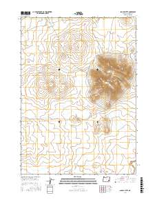
2017 Map of Saddle Butte
USGS Topo · Published 2017About this map
Saddle Butte dominates this high-desert landscape in Malheur County, rising significantly above the surrounding terrain in an area defined by its volcanic geology. This 2017 survey by the U.S. Geological Survey captures the expansive Saddle Butte Lava Field, where complex contour patterns reveal the unique topography of ancient flows and ridges. Seasonal watercourses such as Ryegrass Cr and Bull Cr cut through the arid terrain, providing critical drainage points in a region largely devoid of permanent settlements. The presence of Iron Mountain Rd in the southwestern corner offers the only significant transit route through this remote section of the Oregon interior, reflecting the sparse human footprint and the dominance of the natural landforms in this portion of the state.
Find a feature on this map
10 named features on this map. Tap any name to fly to it.
Don’t see what you’re looking for? This feature index may not catch every label — zoom into the map to look around manually.
Map Details
Editions of this 2017 Saddle Butte Map
This is the sole edition of this map. No revisions or reprints were ever made.
Other maps of this area

1955 · Jordan Valley
USGS Topo · 1:250,000

1955 · Burns
USGS Topo · 1:250,000

1955 · Adel
USGS Topo · 1:250,000

1955 · Boise
USGS Topo · 1:250,000

1957 · Adel
USGS Topo · 1:250,000

1957 · Jordan Valley
USGS Topo · 1:250,000

1958 · Burns
USGS Topo · 1:250,000

1958 · Boise
USGS Topo · 1:250,000

1958 · Adel
USGS Topo · 1:250,000

1958 · Jordan Valley
USGS Topo · 1:250,000