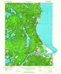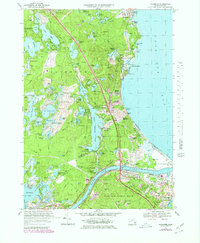
2024 Map of Sagamore
USGS Topo · Published 2024About this map
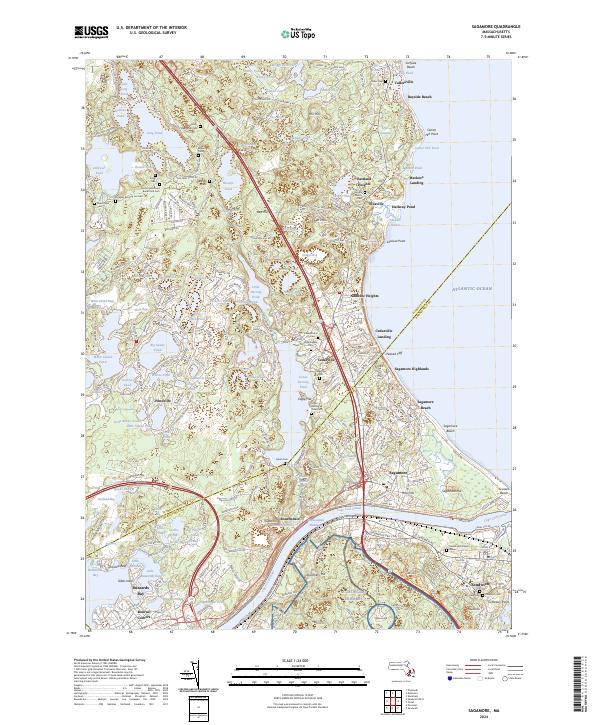
The Cape Cod Canal bisects this coastal landscape, serving as the defining engineering feature that separates the upper reaches of Buzzards Bay from the Atlantic shoreline. This modern survey illustrates the dense network of ponds and cranberry bogs that characterize the interior, with significant water bodies like Hedges Pond and Great Herring Pond punctuating the glacial terrain. The transition from Plymouth to Barnstable county is marked by a string of coastal settlements including Sagamore Beach and Bayside Beach.
Find a feature on this map
283 named features on this map. Tap any name to fly to it.
Don’t see what you’re looking for? This feature index may not catch every label — zoom into the map to look around manually.
Map Details
Editions of this 2024 Sagamore Map
This is the sole edition of this map. No revisions or reprints were ever made.
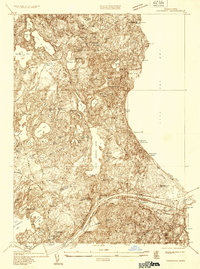
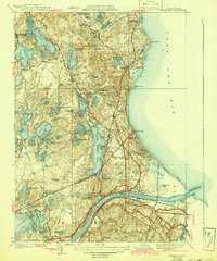
Historical Maps of Nameloc Heights Through Time
6 maps found