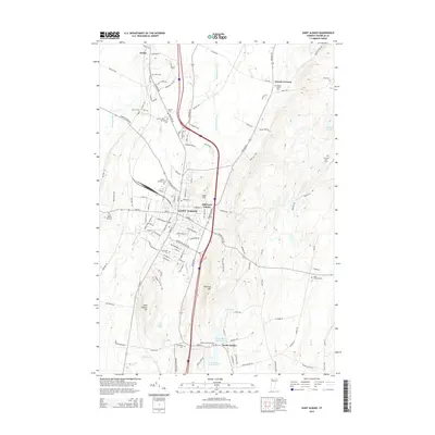
2015 Map of Saint Albans
USGS Topo · Published 2015About this map
Saint Albans serves as the focal point of this Vermont landscape, where the Central Vermont RR cuts through the valley floor. The geography is defined by prominent elevations including Aldis Hill and Bellevue Hill, which overlook the growing residential developments of Hill Farm Estates. A high density of cemeteries, such as the Montefiore Cem, Mount Calvary Cem, and Greenwood Cem, reflects the long-standing community roots and genealogical history of the Saint Albans area. To the south, the village of North Fairfax is situated near the Saint Albans Reservoir N and Saint Albans Reservoir S, where the Mill River flows. This modern survey documents the transition between the urban center and its outlying hamlets like Fonda and Greens Corners amidst a network of drainage basins like Stevens Brook and Hungerford Brook.
Find a feature on this map
130 named features on this map. Tap any name to fly to it.
Don’t see what you’re looking for? This feature index may not catch every label — zoom into the map to look around manually.
Map Details
Editions of this 2015 Saint Albans Map
This is the sole edition of this map. No revisions or reprints were ever made.
Other maps of this area

1913 · Milton
USGS Topo · 1:48,000

1914 · St. Albans
USGS Topo · 1:48,000

1915 · Milton
USGS Topo · 1:62,500

1916 · St. Albans
USGS Topo · 1:62,500

1920 · Franklin Pond
USGS Topo · 1:62,500

1922 · Enosburg Falls
USGS Topo · 1:48,000

1924 · Enosburg Falls
USGS Topo · 1:62,500

1925 · Mount Mansfield
USGS Topo · 1:48,000

1927 · Mount Mansfield
USGS Topo · 1:62,500

1943 · St. Albans
USGS Topo · 1:62,500