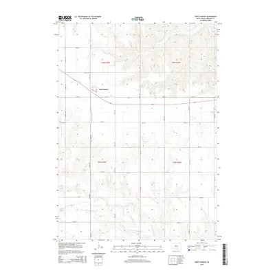
2015 Map of Saint Charles
USGS Topo · Published 2015About this map
Saint Charles sits at the heart of this Gregory County landscape, defined by a rigid grid of rural roads and the undulating drainages of the northern plains. The settlement is anchored by the intersection of Main Ave and Railway St, reflecting a town structure built around transport and trade. This 2015 survey reveals a terrain carved by water, where the headwaters and tributaries of Ponca Cr and Burnt Rock Cr create complex contour patterns against the straight lines of the section borders. To the southwest, the Oscar Micheaux Reservoir and its namesake Oscar Micheaux Cr honor the legacy of the pioneering African American filmmaker and homesteader who farmed in this region. Small upland bodies of water, including Haisch Lake and Bonesteel Lake, punctuate the high ground between the various creek branches, illustrating the local hydrology and land use during this era.
Find a feature on this map
28 named features on this map. Tap any name to fly to it.
Don’t see what you’re looking for? This feature index may not catch every label — zoom into the map to look around manually.
Map Details
Editions of this 2015 Saint Charles Map
This is the sole edition of this map. No revisions or reprints were ever made.
Other maps of this area

1951 · Butte NW
USGS Topo · 1:24,000

1951 · Naper
USGS Topo · 1:24,000

1955 · Mitchell
USGS Topo · 1:250,000

1955 · O'Neill
USGS Topo · 1:250,000

1959 · O'Neill
USGS Topo · 1:250,000

1959 · Mitchell
USGS Topo · 1:250,000

1964 · Herrick NW
USGS Topo · 1:24,000

1964 · Herrick NE
USGS Topo · 1:24,000

1964 · St. Charles
USGS Topo · 1:24,000

1964 · Whetstone Bay
USGS Topo · 1:24,000