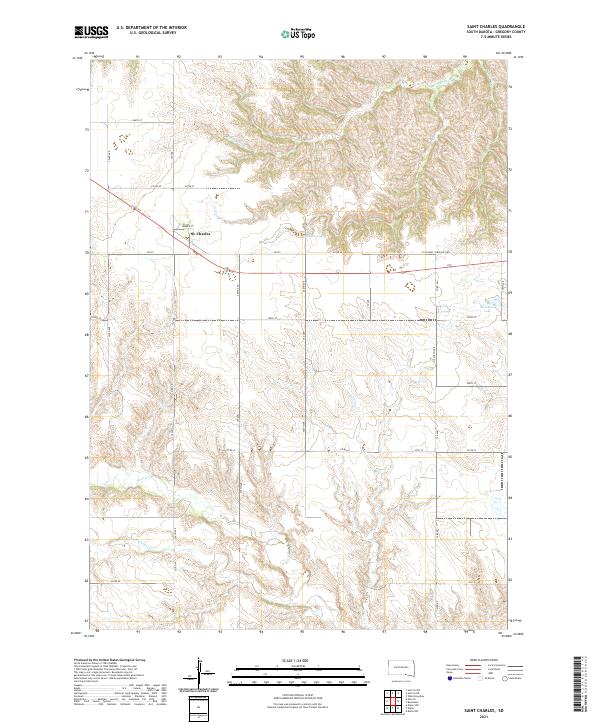
2021 Map of Saint Charles
USGS Topo · Published 2021About this map
St. Charles serves as the central hub of this Gregory County landscape, situated along the St Charles Township Hwy. The terrain is defined by a series of drainage networks, most notably Ponca Cr in the south and Burnt-Rock Cr in the northern reaches. Of particular historical interest is Oscar Micheaux Cr, which winds through the southwestern corner, reflecting the legacy of the pioneering African American filmmaker and author who homesteaded in this region. Water resources are scattered across the township, including Haisch Lake and Bonesteel Lake. The map illustrates a structured grid of rural infrastructure, from Summer St within the settlement to the network of numbered routes like 354th Ave and Co Rd 40 that facilitate movement across the agricultural interior of the Missouri Plateau.
Find a feature on this map
34 named features on this map. Tap any name to fly to it.
Don’t see what you’re looking for? This feature index may not catch every label — zoom into the map to look around manually.
Map Details
Editions of this 2021 Saint Charles Map
This is the sole edition of this map. No revisions or reprints were ever made.
Other maps of this area

1951 · Butte NW
USGS Topo · 1:24,000

1951 · Naper
USGS Topo · 1:24,000

1955 · Mitchell
USGS Topo · 1:250,000

1955 · O'Neill
USGS Topo · 1:250,000

1959 · O'Neill
USGS Topo · 1:250,000

1959 · Mitchell
USGS Topo · 1:250,000

1964 · Herrick NW
USGS Topo · 1:24,000

1964 · Herrick NE
USGS Topo · 1:24,000

1964 · St. Charles
USGS Topo · 1:24,000

1964 · Whetstone Bay
USGS Topo · 1:24,000