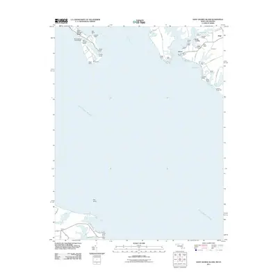
2011 Map of Saint George Island
USGS Topo · Published 2011About this map
Saint George Island sits at the confluence of the Potomac River and the Saint Marys River, defining a landscape where the Chesapeake's maritime heritage is deeply etched into the shoreline. This 2011 survey details a narrow, bridge-linked community anchored by Saint George Island Beach and the recreational grounds of Camp Merryelande. Across the water on the mainland, the map tracks the development of Wynne and surrounding points like Tick Neck and Bards Field, illustrating the area's transition into a modern coastal residential and aviation hub centered around the Chandler Airport. The presence of Miller Wharf, Benville Wharf, and Beans Landing speaks to a long-standing reliance on the surrounding creeks and harbors for commerce and transit. From the southern tip at Travis Point to the sheltered waters of Fox Harbor, the map provides a look at a tidal landscape shaped by the interplay of small settlements and the expansive reach of the Potomac.
Find a feature on this map
50 named features on this map. Tap any name to fly to it.
Don’t see what you’re looking for? This feature index may not catch every label — zoom into the map to look around manually.
Map Details
Editions of this 2011 Saint George Island Map
This is the sole edition of this map. No revisions or reprints were ever made.
Other maps of this area

1892 · Piney Point
USGS Topo · 1:62,500

1894 · Piney Point
USGS Topo · 1:62,500

1894 · Point Lookout
USGS Topo · 1:62,500

1895 · Nomini
USGS Topo · 1:125,000

1895 · Piney Point
USGS Topo · 1:62,500

1898 · Nomini
USGS Topo · 1:125,000

1898 · St. Marys
USGS Topo · 1:125,000

1901 · Piney Point
USGS Topo · 1:62,500

1906 · St. Marys
USGS Topo · 1:125,000

1912 · Point Lookout
USGS Topo · 1:62,500