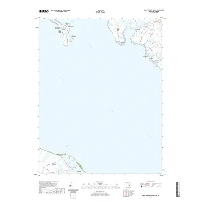
2019 Map of Saint George Island
USGS Topo · Published 2019About this map
St. George Island sits at the northern edge of the Potomac River estuary, a landscape defined by narrow necks of land and sheltered inlets. This 2019 survey captures the modern settlement patterns across ST. Mary'S Co and across the water in Northumberland Co, Virginia. The Maryland side is dominated by tidal geography such as Jutland Neck and Saint Inigoes Neck, where small communities like Wynne and the airfield at Bonham Airport are found. The map illustrates the state boundary as it cuts through the river, separating the southern tip of Maryland from the Virginia shore at Lewisetta and Cherry Point Neck. The numerous named points and bars, including Kitts Point and James Creek Bar, reflect a geography where the economy and local history are inextricably linked to the Chesapeake bay system and its shifting shorelines.
Find a feature on this map
62 named features on this map. Tap any name to fly to it.
Don’t see what you’re looking for? This feature index may not catch every label — zoom into the map to look around manually.
Map Details
Editions of this 2019 Saint George Island Map
This is the sole edition of this map. No revisions or reprints were ever made.
Other maps of this area

1892 · Piney Point
USGS Topo · 1:62,500

1894 · Piney Point
USGS Topo · 1:62,500

1894 · Point Lookout
USGS Topo · 1:62,500

1895 · Nomini
USGS Topo · 1:125,000

1895 · Piney Point
USGS Topo · 1:62,500

1898 · Nomini
USGS Topo · 1:125,000

1898 · St. Marys
USGS Topo · 1:125,000

1901 · Piney Point
USGS Topo · 1:62,500

1906 · St. Marys
USGS Topo · 1:125,000

1912 · Point Lookout
USGS Topo · 1:62,500