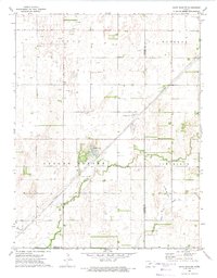
1972 Map of Saint John SW
USGS Topo · Published 1974About this map
The agrarian landscape of central Kansas is defined by the wandering path of Wild Horse Creek and the industrial footprint of energy extraction in the early 1970s. This survey of the border region between Pawnee and Stafford counties reveals a sophisticated network of Pipelines and an expansive Oil and Gas Field. Amidst the township divisions of Valley Center and Cleveland, localized infrastructure like a Compressor Station and Radio Tower serve the rural energy economy. A solitary Grave and a modest Townhall provide glimpses into the sparse human settlement of the era. The presence of James Lake offers a distinct hydrologic break in the undulating terrain otherwise punctuated by numerous Oil Wells and a Drill Hole.
Find a feature on this map
17 named features on this map. Tap any name to fly to it.
Don’t see what you’re looking for? This feature index may not catch every label — zoom into the map to look around manually.
Map Details
Editions of this 1972 Saint John SW Map
This is the sole edition of this map. No revisions or reprints were ever made.
Other maps of this area

1889 · Larned
USGS Topo · 1:125,000

1889 · Kinsley
USGS Topo · 1:125,000

1891 · Great Bend
USGS Topo · 1:125,000

1891 · Larned
USGS Topo · 1:125,000

1892 · Kinsley
USGS Topo · 1:125,000

1892 · Pratt
USGS Topo · 1:125,000

1893 · Great Bend
USGS Topo · 1:125,000

1894 · Kinsley
USGS Topo · 1:125,000

1894 · Pratt
USGS Topo · 1:125,000

1955 · Great Bend
USGS Topo · 1:250,000