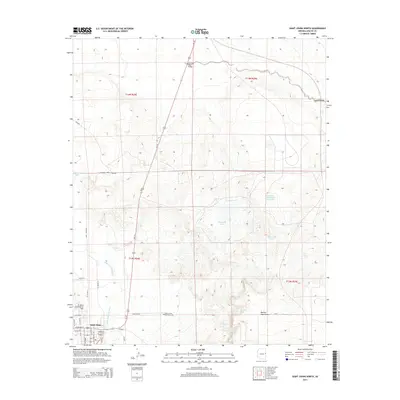
2014 Map of Saint Johns North
USGS Topo · Published 2014About this map
The Little Colorado River winds through the southwestern corner of this high-desert landscape, anchoring the northern edge of Saint Johns. The town's grid extends toward the river, featuring a network of local streets such as Cleveland St and N Water St. Northeast of the residential area, the St Johns Industrial Air Park and the Saint Johns Catholic Cem on Cemetary Rd reflect the community's modern infrastructure and long-standing local history.
Find a feature on this map
34 named features on this map. Tap any name to fly to it.
Don’t see what you’re looking for? This feature index may not catch every label — zoom into the map to look around manually.
Map Details
Editions of this 2014 Saint Johns North Map
This is the sole edition of this map. No revisions or reprints were ever made.
Other maps of this area

1886 · St Johns
USGS Topo · 1:250,000

1892 · St Johns
USGS Topo · 1:250,000

1954 · Saint Johns
USGS Topo · 1:250,000

1955 · Wolford Springs 3 NW
USGS Topo · 1:24,000

1955 · Wolford Springs 3 SW
USGS Topo · 1:24,000

1957 · Saint Johns
USGS Topo · 1:250,000

1958 · Saint Johns
USGS Topo · 1:250,000

1962 · Saint Johns
USGS Topo · 1:250,000

1971 · Mesa Parada NW
USGS Topo · 1:24,000
1971 · Salado
USGS Topo · 1:24,000