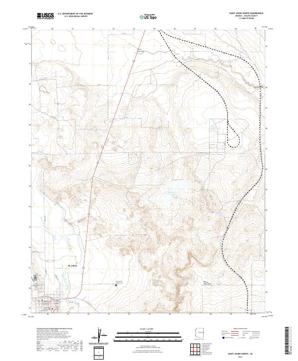
2021 Map of Saint Johns North
USGS Topo · Published 2021About this map
St. Johns serves as the focal point of this northeastern Arizona landscape, where the northern edges of the town site meet the winding course of the Little Colorado River. The area is defined by a series of critical water catchments and drainage features, including Deep Lake Tank, Alejandro Tank, and the notable McIntosh Spring, which are essential markers in this arid high-desert environment. The local infrastructure reflects the civic and educational importance of the seat, containing the Apache County Courthouse and the Northland Pioneer College Saint Johns Center. To the north, the terrain opens into the expansive Marion Haws Draw and is crossed by the Carrizo Wash Bridge. This modern topographic study details the transition from the settled streets of town to the outlying ranching and industrial lands, such as the St Johns Industrial Air Park and the distinct locations of the Saint Johns Cem and Saint Johns Catholic Cem.
Find a feature on this map
31 named features on this map. Tap any name to fly to it.
Don’t see what you’re looking for? This feature index may not catch every label — zoom into the map to look around manually.
Map Details
Editions of this 2021 Saint Johns North Map
This is the sole edition of this map. No revisions or reprints were ever made.
Other maps of this area

1886 · St Johns
USGS Topo · 1:250,000

1892 · St Johns
USGS Topo · 1:250,000

1954 · Saint Johns
USGS Topo · 1:250,000

1955 · Wolford Springs 3 NW
USGS Topo · 1:24,000

1955 · Wolford Springs 3 SW
USGS Topo · 1:24,000

1957 · Saint Johns
USGS Topo · 1:250,000

1958 · Saint Johns
USGS Topo · 1:250,000

1962 · Saint Johns
USGS Topo · 1:250,000

1971 · Mesa Parada NW
USGS Topo · 1:24,000
1971 · Salado
USGS Topo · 1:24,000