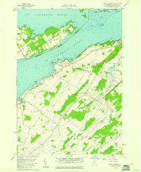
1958 Map of Saint Lawrence
USGS Topo · Published 1961About this map
The St Lawrence River serves as a liquid border between nations in this 1950s survey, where the international boundary separates Wolfe Island, Ontario, from the New York shoreline. This corridor is defined by its navigation aids and island chains, including Francis Island, Arabella Island, and the larger Grindstone Island. Along the New York banks, the landscape transitions from the recreational grounds of Cedar Point State Park to active industrial sites like the Quarries and Sandland Gravel Pits near Sawmill Bay.
Find a feature on this map
66 named features on this map. Tap any name to fly to it.
Don’t see what you’re looking for? This feature index may not catch every label — zoom into the map to look around manually.
Map Details
Editions of this 1958 Saint Lawrence Map
2 editions found
Other maps of this area

1895 · Cape Vincent
USGS Topo · 1:62,500

1900 · Clayton
USGS Topo · 1:62,500

1903 · Grindstone
USGS Topo · 1:62,500

1903 · Clayton
USGS Topo · 1:62,500

1942 · Cape Vincent North
USGS Topo · 1:31,680

1942 · Chaumont
USGS Topo · 1:31,680

1942 · Sawmill Bay
USGS Topo · 1:31,680

1942 · Cape Vincent South
USGS Topo · 1:31,680

1942 · Clayton
USGS Topo · 1:24,000
1943 · Dexter
USGS Topo · 1:31,680