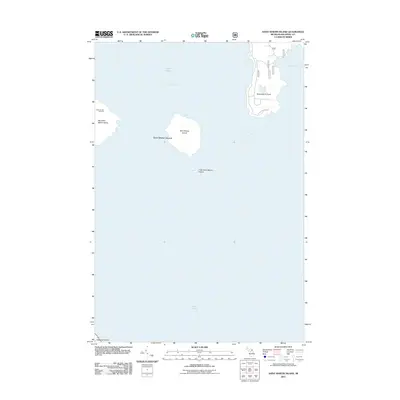
2011 Map of Saint Martin Island
USGS Topo · Published 2011About this map
Indian Burial Ground marks the western edge of Big Saint Martin Island, a significant cultural landmark in this maritime archipelago within Lake Huron. The island group, which also includes Saint Martin Island and Little Saint Martin Island, sits amidst the open waters of Saint Martin Bay. To the east, the mainland projects into the lake at Saint Martin Point, where St Martin Point Rd provides limited access to the shoreline near Search Bay. This survey illustrates the sparse, undeveloped nature of these northern islands in the early 21st century, showing a landscape defined by isolated landmasses and the prominent presence of indigenous heritage sites. The northern tip of Mackinac Island is also visible at the southern margin, grounding the map within this well-known Straits region.
Find a feature on this map
11 named features on this map. Tap any name to fly to it.
Don’t see what you’re looking for? This feature index may not catch every label — zoom into the map to look around manually.
Map Details
Editions of this 2011 Saint Martin Island Map
This is the sole edition of this map. No revisions or reprints were ever made.
Other maps of this area

1931 · St Ignace NW
USGS Topo · 1:31,680

1932 · St Ignace NE
USGS Topo · 1:31,680

1954 · Sault Sainte Marie
USGS Topo · 1:250,000

1955 · Cheboygan
USGS Topo · 1:250,000

1956 · Sault Sainte Marie
USGS Topo · 1:250,000

1957 · Sault Sainte Marie
USGS Topo · 1:250,000

1958 · Cheboygan
USGS Topo · 1:250,000

1958 · Sault Sainte Marie
USGS Topo · 1:250,000

1964 · Round Island
USGS Topo · 1:24,000
1964 · Evergreen Shores
USGS Topo · 1:24,000