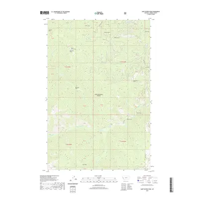
2020 Map of Saint Patrick Peak
USGS Topo · Published 2020About this map
Saint Patrick Peak and Cedar Peak dominate the high-altitude terrain of Mineral County within the protected boundaries of the Lolo National Forest. This 2020 survey illustrates a landscape defined by sharp drainage divides and steep gulches, including Louisiana Gulch and McGinty Gulch, which feed into the extensive hydrological network of Fish Creek. The map shows the intricate path of forest access routes like McFarland Creek Rd and Fish Creek Rd as they navigate the ridges of Heineman Ridge and peaks like McMullan Peak. A series of mountain streams, such as Tanglefoot Creek and Straight Creek, carve through the complex topography. These features indicate a region primarily managed for timber and recreation, with few signs of permanent human settlement beyond the named landmarks and road corridors established for forest management.
Find a feature on this map
47 named features on this map. Tap any name to fly to it.
Don’t see what you’re looking for? This feature index may not catch every label — zoom into the map to look around manually.
Map Details
Editions of this 2020 Saint Patrick Peak Map
This is the sole edition of this map. No revisions or reprints were ever made.
Other maps of this area

1911 · Lolo
USGS Topo · 1:250,000

1913 · Lolo
USGS Topo · 1:250,000

1956 · Wallace
USGS Topo · 1:250,000

1956 · Hamilton
USGS Topo · 1:250,000

1959 · Hamilton
USGS Topo · 1:250,000

1959 · Tarkio
USGS Topo · 1:62,500

1960 · Wallace
USGS Topo · 1:250,000

1960 · Hamilton
USGS Topo · 1:250,000

1960 · Superior
USGS Topo · 1:62,500

1960 · Straight Peak
USGS Topo · 1:62,500