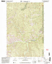
1999 Map of Saint Patrick Peak
USGS Topo · Published 2003About this map
St Patrick Peak and the surrounding high country of the Lolo National Forest define this 1999 revision of the Mineral County landscape. The area is characterized by high ridges like McFarland Ridge and Heineman Ridge that drop into a complex drainage system, most notably where the North Fork Fish Creek meets the West Fork Fish Creek. This convergence point is a hub of activity on the map, featuring Clearwater Crossing, the Clearwater Crossing FS Ranger Station, and the Hide-in-the-Wall Lodge.
Find a feature on this map
23 named features on this map. Tap any name to fly to it.
Don’t see what you’re looking for? This feature index may not catch every label — zoom into the map to look around manually.
Map Details
Editions of this 1999 Saint Patrick Peak Map
This is the sole edition of this map. No revisions or reprints were ever made.
Other maps of this area

1911 · Lolo
USGS Topo · 1:250,000

1913 · Lolo
USGS Topo · 1:250,000

1956 · Wallace
USGS Topo · 1:250,000

1956 · Hamilton
USGS Topo · 1:250,000

1959 · Hamilton
USGS Topo · 1:250,000

1959 · Tarkio
USGS Topo · 1:62,500

1960 · Wallace
USGS Topo · 1:250,000

1960 · Hamilton
USGS Topo · 1:250,000

1960 · Superior
USGS Topo · 1:62,500

1960 · Straight Peak
USGS Topo · 1:62,500