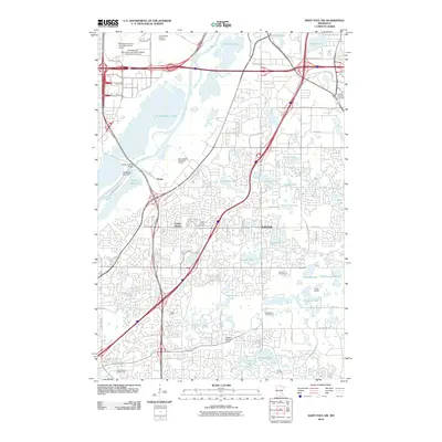
2010 Map of Saint Paul SW
USGS Topo · Published 2010About this map
Eagan and the suburban expanses south of the Minnesota River characterize this 2010 topographic study. The river corridor is dominated by broad wetlands and water bodies such as Long Meadow Lake and Black Dog Lake, the latter featuring the Blackdog Lake Dam. These natural features stand in contrast to the heavy infrastructure of the Minneapolis-Saint Paul International Airport and the expansive Fort Snelling National Cemetery in the northern portion of the quadrangle.
Find a feature on this map
59 named features on this map. Tap any name to fly to it.
Don’t see what you’re looking for? This feature index may not catch every label — zoom into the map to look around manually.
Map Details
Editions of this 2010 Saint Paul SW Map
This is the sole edition of this map. No revisions or reprints were ever made.
Other maps of this area

1896 · Minneapolis
USGS Topo · 1:62,500

1896 · St. Paul
USGS Topo · 1:62,500

1901 · Minneapolis
USGS Topo · 1:62,500

1951 · St. Paul West
USGS Topo · 1:24,000

1951 · Inver Grove
USGS Topo · 1:24,000

1951 · St. Paul SW
USGS Topo · 1:24,000

1951 · St. Paul East
USGS Topo · 1:24,000

1951 · St. Paul
USGS Topo · 1:62,500

1952 · Minneapolis South
USGS Topo · 1:24,000

1953 · Saint Paul
USGS Topo · 1:250,000