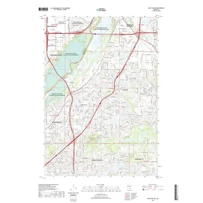
2019 Map of Saint Paul SW
USGS Topo · Published 2019About this map
Fort Snelling National Cemetery and the expansive Minnesota Valley National Wildlife Refuge dominate the landscape at the confluence of the regional river systems. This modern survey illustrates the suburban expansion of Bloomington, Eagan, and Burnsville around the winding corridor of the Minnesota River. Significant wetland and ecological preservation areas, including the Mississippi National River and Recreation Area, are clearly delineated, showing a complex network of lakes such as Long Meadow Lake and Black Dog Lake. The map captures the dense infrastructure of the modern era, featuring the intersection of major transit routes and the preservation of historical burial grounds like Saint Johns Cem and Trinity Lone Oak Cem. It serves as an essential reference for understanding how these communities integrated large-scale conservation zones with rapid residential and commercial development in the late 2010s.
Find a feature on this map
326 named features on this map. Tap any name to fly to it.
Don’t see what you’re looking for? This feature index may not catch every label — zoom into the map to look around manually.
Map Details
Editions of this 2019 Saint Paul SW Map
This is the sole edition of this map. No revisions or reprints were ever made.
Other maps of this area

1896 · Minneapolis
USGS Topo · 1:62,500

1896 · St. Paul
USGS Topo · 1:62,500

1901 · Minneapolis
USGS Topo · 1:62,500

1951 · St. Paul West
USGS Topo · 1:24,000

1951 · Inver Grove
USGS Topo · 1:24,000

1951 · St. Paul SW
USGS Topo · 1:24,000

1951 · St. Paul East
USGS Topo · 1:24,000

1951 · St. Paul
USGS Topo · 1:62,500

1952 · Minneapolis South
USGS Topo · 1:24,000

1953 · Saint Paul
USGS Topo · 1:250,000