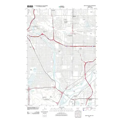
2010 Map of Saint Paul West
USGS Topo · Published 2010About this map
The Mississippi River and Minnesota River converge at the heart of this Twin Cities landscape, where historic settlements and massive institutional footprints meet. The confluence near Pike Island serves as a geographic anchor, situated just north of Mendota and the sprawling grounds of the Minneapolis-Saint Paul International Airport. Educational history is deeply embedded in the urban fabric here, with the University of Minnesota campus dominating the northern river bluffs while Hamline University, the University of Saint Thomas, and Concordia University - Saint Paul occupy established neighborhoods to the east.
Find a feature on this map
60 named features on this map. Tap any name to fly to it.
Don’t see what you’re looking for? This feature index may not catch every label — zoom into the map to look around manually.
Map Details
Editions of this 2010 Saint Paul West Map
This is the sole edition of this map. No revisions or reprints were ever made.
Other maps of this area

1896 · Minneapolis
USGS Topo · 1:62,500

1896 · St. Paul
USGS Topo · 1:62,500

1901 · Minneapolis
USGS Topo · 1:62,500

1902 · White Bear
USGS Topo · 1:62,500

1902 · Anoka
USGS Topo · 1:62,500

1951 · St. Paul West
USGS Topo · 1:24,000

1951 · Inver Grove
USGS Topo · 1:24,000

1951 · St. Paul SW
USGS Topo · 1:24,000

1951 · St. Paul East
USGS Topo · 1:24,000

1951 · St. Paul
USGS Topo · 1:62,500