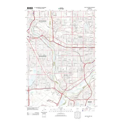
2013 Map of Saint Paul West
USGS Topo · Published 2013About this map
The confluence of the Mississippi River and Minnesota River anchors this 2013 survey, highlighting the geographic heart of the Twin Cities. This area serves as a massive educational and institutional corridor, home to the University of Minnesota-Twin Cities, Macalester College, and Hamline University. The landscape is a dense network of transit and legacy sites, where the Soo Line railroad and a grid of historic avenues like University Avenue SE connect the distinct urban centers of Minneapolis and St Paul.
Find a feature on this map
108 named features on this map. Tap any name to fly to it.
Don’t see what you’re looking for? This feature index may not catch every label — zoom into the map to look around manually.
Map Details
Editions of this 2013 Saint Paul West Map
This is the sole edition of this map. No revisions or reprints were ever made.
Other maps of this area

1896 · Minneapolis
USGS Topo · 1:62,500

1896 · St. Paul
USGS Topo · 1:62,500

1901 · Minneapolis
USGS Topo · 1:62,500

1902 · White Bear
USGS Topo · 1:62,500

1902 · Anoka
USGS Topo · 1:62,500

1951 · St. Paul West
USGS Topo · 1:24,000

1951 · Inver Grove
USGS Topo · 1:24,000

1951 · St. Paul SW
USGS Topo · 1:24,000

1951 · St. Paul East
USGS Topo · 1:24,000

1951 · St. Paul
USGS Topo · 1:62,500