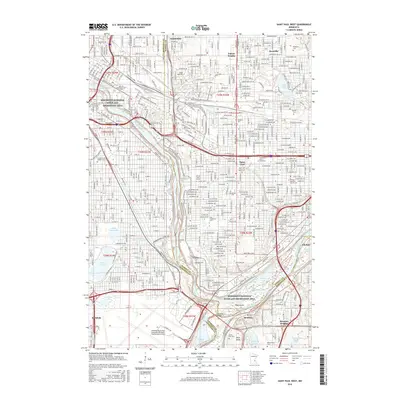
2016 Map of Saint Paul West
USGS Topo · Published 2016About this map
The Mississippi River carves a deep valley through the heart of the Twin Cities, defining the urban geography of Saint Paul and its western suburbs. This survey details the concentration of higher education institutions that anchor the region, including Hamline Univ, Macalester Coll, and Saint Catherine Univ. The landscape is a mix of established residential grids and significant green spaces, from the waters of Lake Nokomis and Lake Hiawatha in the west to the historic grounds of Lake Como in the northeast.
Find a feature on this map
53 named features on this map. Tap any name to fly to it.
Don’t see what you’re looking for? This feature index may not catch every label — zoom into the map to look around manually.
Map Details
Editions of this 2016 Saint Paul West Map
This is the sole edition of this map. No revisions or reprints were ever made.
Other maps of this area

1896 · Minneapolis
USGS Topo · 1:62,500

1896 · St. Paul
USGS Topo · 1:62,500

1901 · Minneapolis
USGS Topo · 1:62,500

1902 · White Bear
USGS Topo · 1:62,500

1902 · Anoka
USGS Topo · 1:62,500

1951 · St. Paul West
USGS Topo · 1:24,000

1951 · Inver Grove
USGS Topo · 1:24,000

1951 · St. Paul SW
USGS Topo · 1:24,000

1951 · St. Paul East
USGS Topo · 1:24,000

1951 · St. Paul
USGS Topo · 1:62,500