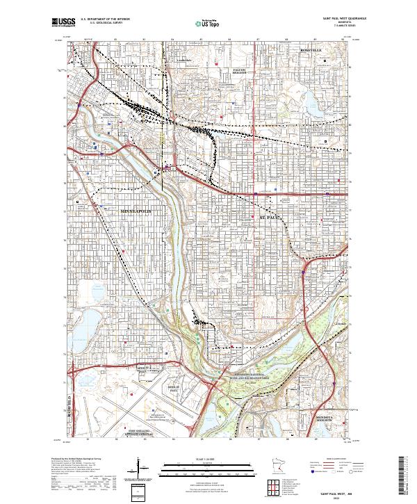
2022 Map of Saint Paul West
USGS Topo · Published 2022About this map
The Mississippi River carves a deep valley through the center of this urban landscape, defining the boundary between Minneapolis and St. Paul. This area is a dense concentration of higher education and institutional history, featuring the University of Minnesota Twin Cities Campus and Augsburg College on the western bank, while the eastern side is home to Hamline University, Macalester College, and St Catherine University. The map documents the extensive parklands and natural water bodies that dot the cities, from the recreational shores of Lake Como and Lake Hiawatha to the federally protected Mississippi National River and Recreation Area. At the southern confluence, the grounds of Fort Snelling National Cemetery and the Fort Snelling Military Hwy mark a site of significant regional heritage where Pike Island sits at the junction of the great river and its tributaries.
Find a feature on this map
72 named features on this map. Tap any name to fly to it.
Don’t see what you’re looking for? This feature index may not catch every label — zoom into the map to look around manually.
Map Details
Editions of this 2022 Saint Paul West Map
This is the sole edition of this map. No revisions or reprints were ever made.
Other maps of this area

1896 · Minneapolis
USGS Topo · 1:62,500

1896 · St. Paul
USGS Topo · 1:62,500

1901 · Minneapolis
USGS Topo · 1:62,500

1902 · White Bear
USGS Topo · 1:62,500

1902 · Anoka
USGS Topo · 1:62,500

1951 · St. Paul West
USGS Topo · 1:24,000

1951 · Inver Grove
USGS Topo · 1:24,000

1951 · St. Paul SW
USGS Topo · 1:24,000

1951 · St. Paul East
USGS Topo · 1:24,000

1951 · St. Paul
USGS Topo · 1:62,500