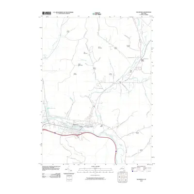
2010 Map of Salamanca
USGS Topo · Published 2010About this map
The city of Salamanca sits at the heart of this 2010 survey, where the Allegheny River flows through Cattaraugus County toward the Allegheny Reservoir. This river valley geography is central to the area's development, with the larger settlement of Salamanca and the smaller community of Kill Buck positioned along the river's path. To the north, the landscape transitions into more varied terrain marked by numerous hollows and peaks, such as Oyer Mountain and Smith Mountain. Genealogists and local historians can find detailed site markers including Wildwood Cemetery and Calvary Cemetery, as well as the unique geological formation of Little Rock City. The northern portion of the map highlights a series of tributary waters like Whig Street Creek and Great Valley Creek, which converge near the village of Great Valley and its local Great Valley Airport.
Find a feature on this map
66 named features on this map. Tap any name to fly to it.
Don’t see what you’re looking for? This feature index may not catch every label — zoom into the map to look around manually.
Map Details
Editions of this 2010 Salamanca Map
This is the sole edition of this map. No revisions or reprints were ever made.
Other maps of this area

1900 · Salamanca
USGS Topo · 1:62,500

1922 · Randolph
USGS Topo · 1:62,500

1923 · Randolph
USGS Topo · 1:62,500

1923 · Cattaraugus
USGS Topo · 1:62,500

1924 · Ellicottville
USGS Topo · 1:62,500

1938 · Cattaraugus
USGS Topo · 1:62,500

1938 · Salamanca
USGS Topo · 1:62,500

1941 · Cattaraugus
USGS Topo · 1:62,500

1941 · Ellicottville
USGS Topo · 1:62,500

1943 · Randolph
USGS Topo · 1:62,500