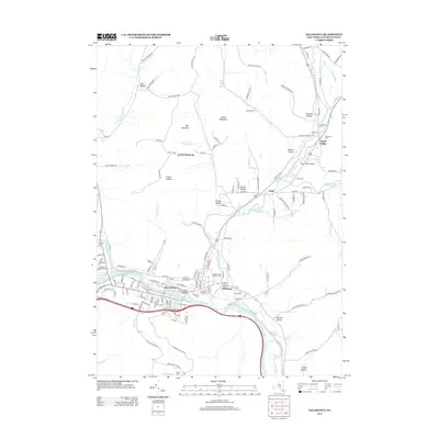
2013 Map of Salamanca
USGS Topo · Published 2013About this map
The Allegheny River and its massive Allegheny Reservoir dominate the southern half of this landscape, carving a wide valley where the city of Salamanca and the village of Kill Buck are situated. This area reflects a dense network of local history, with several burial grounds including Wildwood Cem, Calvary Cem, and the Ellicott Street Catholic Cem serving the riverfront communities. North of the river, the terrain rises into high ridges and hollows, such as Mutton Hollow and Hungry Hollow, punctuated by peaks like Oyer Mountain and Smith Mountain. In the northeast corner, the valley of Great Valley Creek supports the settlement of Great Valley, featuring the Great Valley Airport and Wild Acres Farm. The convergence of these waterways and valleys defined the transport corridors of the early 21st century, seen in the transition from riverfront industry to the highlands at Little Rock City.
Find a feature on this map
135 named features on this map. Tap any name to fly to it.
Don’t see what you’re looking for? This feature index may not catch every label — zoom into the map to look around manually.
Map Details
Editions of this 2013 Salamanca Map
This is the sole edition of this map. No revisions or reprints were ever made.
Other maps of this area

1900 · Salamanca
USGS Topo · 1:62,500

1922 · Randolph
USGS Topo · 1:62,500

1923 · Randolph
USGS Topo · 1:62,500

1923 · Cattaraugus
USGS Topo · 1:62,500

1924 · Ellicottville
USGS Topo · 1:62,500

1938 · Cattaraugus
USGS Topo · 1:62,500

1938 · Salamanca
USGS Topo · 1:62,500

1941 · Cattaraugus
USGS Topo · 1:62,500

1941 · Ellicottville
USGS Topo · 1:62,500

1943 · Randolph
USGS Topo · 1:62,500