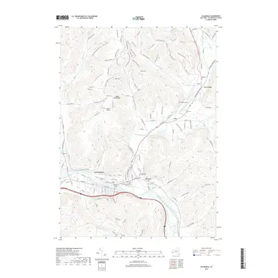
2019 Map of Salamanca
USGS Topo · Published 2019About this map
Salamanca sits at a critical junction where the Allegheny River meets the drainages of Little Valley Creek and Newton Run. This landscape is defined by its deep glacial and fluvial valleys, including Mutton Hollow, Christian Hollow, and Thorpe Hollow. To the north, the terrain rises sharply toward Little Rock City and Smith Mountain, while the valley floors support the communities of Kill Buck, Peth, and Great Valley. Genealogists will find a wealth of burial sites across the township, from the centrally located Calvary Cemetery and Ellicott Street Catholic Cemetery to the more outlying Chamberlain Cemetery and Crawford Cemetery. The map also traces the North Country National Scenic Trail as it winds past Oyer Mountain and Lindell Lookout, providing a detailed record of the recreational and natural corridors surrounding the urban center.
Find a feature on this map
118 named features on this map. Tap any name to fly to it.
Don’t see what you’re looking for? This feature index may not catch every label — zoom into the map to look around manually.
Map Details
Editions of this 2019 Salamanca Map
This is the sole edition of this map. No revisions or reprints were ever made.
Other maps of this area

1900 · Salamanca
USGS Topo · 1:62,500

1922 · Randolph
USGS Topo · 1:62,500

1923 · Randolph
USGS Topo · 1:62,500

1923 · Cattaraugus
USGS Topo · 1:62,500

1924 · Ellicottville
USGS Topo · 1:62,500

1938 · Cattaraugus
USGS Topo · 1:62,500

1938 · Salamanca
USGS Topo · 1:62,500

1941 · Cattaraugus
USGS Topo · 1:62,500

1941 · Ellicottville
USGS Topo · 1:62,500

1943 · Randolph
USGS Topo · 1:62,500