2023 Map of Salamanca
USGS Topo · Published 2023About this map
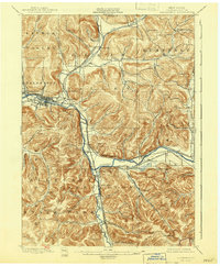
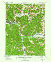
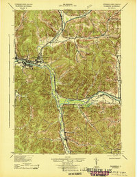
Salamanca and the surrounding river valley are defined by the winding path of the Allegheny River as it moves westward through Cattaraugus County. The modern settlement pattern clusters along the river corridor and Great Valley Creek, with the city center anchored by Wildwood Cem and Calvary Cem. To the north, the landscape rises into significant high ground, including Oyer Mountain and Smith Mountain, where the unusual geologic formations of Little Rock City and the Lindell Lookout offer vantage points over the hollows.
Find a feature on this map
135 named features on this map. Tap any name to fly to it.
Don’t see what you’re looking for? This feature index may not catch every label — zoom into the map to look around manually.
Map Details
Editions of this 2023 Salamanca Map
This is the sole edition of this map. No revisions or reprints were ever made.
Historical Maps of Kill Buck Through Time
5 maps found