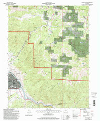
1994 Map of Salida East
USGS Topo · Published 1998About this map
Salida serves as the focal point of this Chaffee County survey, where the town's street grid meets the winding course of the Arkansas River. The landscape transition is marked by prominent landmarks like Tenderfoot Hill and the winding path of Spiral Drive, which overlooks the community's civic infrastructure, including the Courthouse, Hospital, and St Joseph School. Southeast along the river, the settlement of Cleora and a nearby Cemetery reflect the area's historic rail and riverside development.
Find a feature on this map
54 named features on this map. Tap any name to fly to it.
Don’t see what you’re looking for? This feature index may not catch every label — zoom into the map to look around manually.
Map Details
Editions of this 1994 Salida East Map
This is the sole edition of this map. No revisions or reprints were ever made.
Other maps of this area

1954 · Pueblo
USGS Topo · 1:250,000

1956 · Cameron Mountain
USGS Topo · 1:62,500

1956 · Poncha Springs
USGS Topo · 1:62,500

1956 · Montrose
USGS Topo · 1:250,000

1957 · Pueblo
USGS Topo · 1:250,000

1958 · Pueblo
USGS Topo · 1:250,000

1959 · Montrose
USGS Topo · 1:250,000

1959 · Bonanza
USGS Topo · 1:62,500

1959 · Howard
USGS Topo · 1:62,500

1960 · Montrose
USGS Topo · 1:250,000