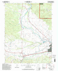
1994 Map of Salida West
USGS Topo · Published 1998About this map
The Arkansas River corridor in Chaffee County serves as the central artery for this late-20th-century landscape, carving through a series of distinct geographic basins including Sand Park, Adobe Park, and Missouri Park. The settlement pattern is defined by the established hub of Poncha Springs and the industrial character of Smeltertown north of Salida. A complex network of irrigation infrastructure, such as the Missouri Park Ditch, Kraft Ditch, and Monte Ditch, reveals the intensive water management required for agriculture and local operations like the Shavano State Fish Hatchery.
Find a feature on this map
47 named features on this map. Tap any name to fly to it.
Don’t see what you’re looking for? This feature index may not catch every label — zoom into the map to look around manually.
Map Details
Editions of this 1994 Salida West Map
This is the sole edition of this map. No revisions or reprints were ever made.
Other maps of this area

1954 · Pueblo
USGS Topo · 1:250,000

1956 · Cameron Mountain
USGS Topo · 1:62,500

1956 · Poncha Springs
USGS Topo · 1:62,500

1956 · Montrose
USGS Topo · 1:250,000

1957 · Pueblo
USGS Topo · 1:250,000

1958 · Pueblo
USGS Topo · 1:250,000

1959 · Montrose
USGS Topo · 1:250,000

1959 · Bonanza
USGS Topo · 1:62,500

1959 · Howard
USGS Topo · 1:62,500

1960 · Montrose
USGS Topo · 1:250,000