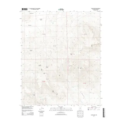
2013 Map of Salinas Peak
USGS Topo · Published 2013About this map
The San Andres Mountains dominate this high-elevation terrain in Sierra County, culminating at the summit of Salinas Peak. The landscape is a network of deep canyons and ridges, including Grapevine Canyon, Jonce Canyon, and Thurgood Canyon, which drain into seasonal watercourses like Good Fortune Cr. This 2013 survey illustrates the critical role of water management in this arid environment, marked by numerous named springs such as Dripping Spring, Indian Spring, and Eagle Pass Spring, alongside man-made features like Jonce Tank. Local history and genealogy interest is concentrated in family-named landmarks and peaks, including White Mine Peak, Ladybug Peak, and Silver Top Mtn. The presence of Wsmr P Route 13 indicates the area's modern role within the White Sands Missile Range, while surveying lines like t11s r4e divide the vast, high-desert allotments.
Find a feature on this map
38 named features on this map. Tap any name to fly to it.
Don’t see what you’re looking for? This feature index may not catch every label — zoom into the map to look around manually.
Map Details
Editions of this 2013 Salinas Peak Map
This is the sole edition of this map. No revisions or reprints were ever made.
Other maps of this area

1916 · Salinas Peak
USGS Topo · 1:125,000

1916 · Tularosa
USGS Topo · 1:125,000

1947 · Capitol Peak
USGS Topo · 1:62,500

1948 · Black Top Mountain
USGS Topo · 1:62,500

1948 · Salinas Peak
USGS Topo · 1:62,500

1948 · Lumley Lake
USGS Topo · 1:62,500

1954 · Tularosa
USGS Topo · 1:250,000

1958 · Tularosa
USGS Topo · 1:250,000

1981 · Big Gyp Mountain
USGS Topo · 1:24,000

1981 · Fairview Mountain
USGS Topo · 1:24,000