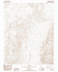
1987 Map of Saline Peak
USGS Topo · Published 1987About this map
Saline Range and the high desert elevations of Inyo County dominate this 1987 provisional survey, where dramatic vertical relief defines the eastern California landscape. The topography is anchored by the prominent Saline Peak, rising sharply above the expansive floor of Saline Valley to the east. This map captures a region primarily accessible via unpaved 4wd routes, reflecting the isolation of the Great Basin terrain during the late twentieth century. Unlike more developed areas, this quadrangle focuses on natural landmarks like Black Top, offering a precise record of the physical geography and township boundaries including T 12 S and R 39 E. The survey represents the area as it was documented through aerial photography in the early 1980s, preserving the state of these remote desert corridors before any further modern mapping updates.
Find a feature on this map
7 named features on this map. Tap any name to fly to it.
Don’t see what you’re looking for? This feature index may not catch every label — zoom into the map to look around manually.
Map Details
Editions of this 1987 Saline Peak Map
This is the sole edition of this map. No revisions or reprints were ever made.
Other maps of this area

1908 · Lida
USGS Topo · 1:250,000

1908 · Ballarat
USGS Topo · 1:250,000

1913 · Lida
USGS Topo · 1:250,000

1913 · Ballarat
USGS Topo · 1:250,000

1948 · Death Valley
USGS Topo · 1:250,000

1951 · Waucoba Wash
USGS Topo · 1:62,500

1954 · Death Valley
USGS Topo · 1:250,000

1954 · Goldfield
USGS Topo · 1:250,000

1955 · Goldfield
USGS Topo · 1:250,000

1956 · Death Valley
USGS Topo · 1:250,000