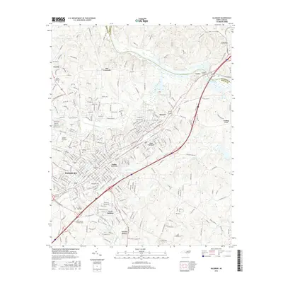
2016 Map of Salisbury
USGS Topo · Published 2016About this map
The city of Salisbury serves as the focal point of this Rowan County survey, showing a landscape deeply shaped by its educational and commemorative landmarks. Educational institutions like Catawba Coll, Livingstone Coll, and the Hood Theological Seminary are prominently situated, alongside the expansive Salisbury National Cem Annex. The map documents the urban transition from the historic center out toward the industrial and transit hubs of East Spencer and Yadkin Junction, where the rail corridors converge near the Yadkin River. To the northeast, the geography shifts toward the water as the river opens into High Rock Lake at Beards Bridge. Smaller outlying communities such as Granite Quarry and Trading Ford provide context for the county's broader settlement patterns, while the rugged profile of Dunn Mtn stands out as a distinct topographical feature south of the primary municipal center.
Find a feature on this map
300 named features on this map. Tap any name to fly to it.
Don’t see what you’re looking for? This feature index may not catch every label — zoom into the map to look around manually.
Map Details
Editions of this 2016 Salisbury Map
This is the sole edition of this map. No revisions or reprints were ever made.
Other maps of this area

1893 · Statesville
USGS Topo · 1:125,000

1950 · Lexington West
USGS Topo · 1:24,000

1950 · Churchland
USGS Topo · 1:24,000

1951 · Churchland
USGS Topo · 1:24,000

1951 · Lexington West
USGS Topo · 1:24,000

1953 · Charlotte
USGS Topo · 1:250,000

1954 · Charlotte
USGS Topo · 1:250,000

1960 · Charlotte
USGS Topo · 1:250,000

1962 · Charlotte
USGS Topo · 1:250,000

1962 · Southmont
USGS Topo · 1:24,000