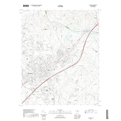
2019 Map of Salisbury
USGS Topo · Published 2019About this map
Salisbury serves as a dense urban and historical center in this modern topographical record, where the convergence of the Southern Railway and Norfolk Southern lines highlights the city's enduring role as a regional transportation hub. The landscape is deeply marked by local heritage, evidenced by a concentration of significant burial grounds such as the Salisbury National Cem Annex and the Old English Cem. Outside the city core, the terrain shifts toward industrial and natural landmarks, notably the namesake Granite Quarry and the prominent rise of Dunn Mtn. The Yadkin River defines the northeastern boundary, crossed by Beards Bridge near the settlement of Lakeview. Educational institutions like Hood Theological Seminary and Rowan-Cabarrus Community Coll anchor the southern reaches of the city, illustrating the continued growth of South Salisbury and its surrounding communities.
Find a feature on this map
294 named features on this map. Tap any name to fly to it.
Don’t see what you’re looking for? This feature index may not catch every label — zoom into the map to look around manually.
Map Details
Editions of this 2019 Salisbury Map
This is the sole edition of this map. No revisions or reprints were ever made.
Other maps of this area

1893 · Statesville
USGS Topo · 1:125,000

1950 · Lexington West
USGS Topo · 1:24,000

1950 · Churchland
USGS Topo · 1:24,000

1951 · Churchland
USGS Topo · 1:24,000

1951 · Lexington West
USGS Topo · 1:24,000

1953 · Charlotte
USGS Topo · 1:250,000

1954 · Charlotte
USGS Topo · 1:250,000

1960 · Charlotte
USGS Topo · 1:250,000

1962 · Charlotte
USGS Topo · 1:250,000

1962 · Southmont
USGS Topo · 1:24,000