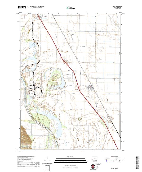
2022 Map of Salix
USGS Topo · Published 2022About this map
Salix serves as the central hub of this agricultural landscape in Woodbury County, positioned just south of the Sioux City metropolitan area. The terrain is defined by the proximity of the Missouri River, which forms the western boundary between Iowa and Nebraska. This riparian corridor features significant oxbow formations, most notably Browns Lake and the smaller Brouwers Lake to the north. The survey reveals a highly organized township structure, where rural life is anchored by local landmarks such as Saint Josephs Cem, Liberty Township Cem, and Walnut Grove Cem. Transportation and infrastructure are prominent, with the Farmers Canal cutting across the eastern plains and the Lakeport Farms Airport situated in the southern reach. The grid of section lines and county roads, including Port Neal Rd and Old Hwy 75, illustrates a landscape dedicated to large-scale farming and river-valley transit.
Find a feature on this map
57 named features on this map. Tap any name to fly to it.
Don’t see what you’re looking for? This feature index may not catch every label — zoom into the map to look around manually.
Map Details
Editions of this 2022 Salix Map
This is the sole edition of this map. No revisions or reprints were ever made.
Other maps of this area

1955 · Sioux City
USGS Topo · 1:250,000

1958 · Sioux City
USGS Topo · 1:250,000

1959 · Sioux City
USGS Topo · 1:250,000

1963 · Sioux City South
USGS Topo · 1:24,000

1964 · Sergeant Bluff
USGS Topo · 1:24,000

1964 · Lawton
USGS Topo · 1:24,000

1964 · Luton
USGS Topo · 1:24,000

1964 · Homer
USGS Topo · 1:24,000

1964 · Salix
USGS Topo · 1:24,000

1966 · Walthill
USGS Topo · 1:24,000