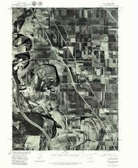
1977 Map of Salix
USGS Topo · Published 1979About this map
Salix stands as a focal point in this orthophotoquad, which showcases the agricultural patterns and river dynamics of the Iowa-Nebraska border. Developed from 1977 aerial photography, the imagery provides a clear view of the complex oxbow lakes and meander scars left by the Missouri River as it defines the western boundary of the region. This specific format—a rectified photographic image rather than a traditional line drawing—captures the precise texture of the floodplain, revealing how field boundaries and farmsteads have been adapted to the winding path of the river. The small settlement of Salix appears as a compact grid surrounded by large-scale farming operations, illustrating the rural character of Woodbury County during the late 1970s.
Find a feature on this map
2 named features on this map. Tap any name to fly to it.
Don’t see what you’re looking for? This feature index may not catch every label — zoom into the map to look around manually.
Map Details
Editions of this 1977 Salix Map
This is the sole edition of this map. No revisions or reprints were ever made.
Other maps of this area

1955 · Sioux City
USGS Topo · 1:250,000

1958 · Sioux City
USGS Topo · 1:250,000

1959 · Sioux City
USGS Topo · 1:250,000

1963 · Sioux City South
USGS Topo · 1:24,000

1964 · Sergeant Bluff
USGS Topo · 1:24,000

1964 · Lawton
USGS Topo · 1:24,000

1964 · Luton
USGS Topo · 1:24,000

1964 · Homer
USGS Topo · 1:24,000

1964 · Salix
USGS Topo · 1:24,000

1966 · Walthill
USGS Topo · 1:24,000