Loading...
Loading map...2023 Map of Salladasburg
USGS Topo · Published 2023About this map
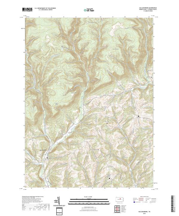
Salladasburg anchors the southwestern corner of this landscape, situated at the confluence where the Second Fork Larrys Creek meets the main branch of Larrys Creek. The terrain is defined by a dense network of steep hollows and narrow ridges, such as Spook Hollow and Match Pine Hollow, which channel numerous tributaries toward the West Branch Susquehanna River valley to the south.
Find a feature on this map
80 named features on this map. Tap any name to fly to it.
Don’t see what you’re looking for? This feature index may not catch every label — zoom into the map to look around manually.
Map Details
Date Portrayed2023
Date Published2023
PublisherU.S. Geological Survey
Map TypeTopographic
Scale1:24000
Physical Dimensions24 x 29 inches
Editions of this 2023 Salladasburg Map
This is the sole edition of this map. No revisions or reprints were ever made.
Historical Maps of Anthony Township Through Time
Featured Locations
Source Details
SourceU.S. Geological Survey
CopyrightPublic Domain