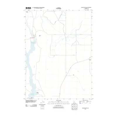
2010 Map of Salmon Butte
USGS Topo · Published 2010About this map
Salmon Falls Creek Reservoir dominates this landscape in southern Idaho, serving as a critical water source for the surrounding high desert agricultural lands. Managed by the Salmon Falls Dam at its northern end, the reservoir's waters are diverted into an intricate irrigation network featuring the Main Canal and various distributors like A Lateral. The terrain is defined by dramatic changes in elevation, from the depths of Antelope Canyon and McCongle Canyon to the prominent peak of Salmon Butte. While much of the area is dedicated to large-scale water management and open range, small points of human activity are noted at Greys Landing on the reservoir shore and the Point Ranch further east. Remote access through this territory is maintained by local routes such as Three Creek Rd and 1520 North Rd.
Find a feature on this map
15 named features on this map. Tap any name to fly to it.
Don’t see what you’re looking for? This feature index may not catch every label — zoom into the map to look around manually.
Map Details
Editions of this 2010 Salmon Butte Map
This is the sole edition of this map. No revisions or reprints were ever made.
Other maps of this area

1955 · Twin Falls
USGS Topo · 1:250,000

1958 · Twin Falls
USGS Topo · 1:250,000

1965 · Hollister SW
USGS Topo · 1:24,000

1965 · Roseworth SE
USGS Topo · 1:24,000

1965 · Hollister
USGS Topo · 1:24,000

1977 · Browns Bench South
USGS Topo · 1:24,000

1977 · Rogerson
USGS Topo · 1:24,000

1977 · Magic Hot Springs
USGS Topo · 1:24,000

1977 · Salmon Butte
USGS Topo · 1:24,000

1978 · Browns Bench North
USGS Topo · 1:24,000