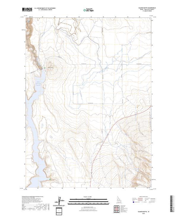
2024 Map of Salmon Butte
USGS Topo · Published 2024About this map
Salmon Falls Creek Reservoir dominates this high-desert landscape in southwestern Twin Falls County, where the interplay of natural drainage and engineered irrigation is clearly visible. The namesake Salmon Butte rises prominently east of the water, overlooking a network of agricultural infrastructure including the Main Canal and A Lateral. These water management systems trace the contours of the land, supporting local ranching and farming operations north of the canyon lands. The terrain is defined by deep incisions like Antelope Canyon to the northwest and McCongle Canyon to the southeast, illustrating the erosive power of Salmon Falls Creek and its tributaries. Historic transit routes such as Jarbidge Rd and Three Creek Rd provide access through this expansive cattle country, connecting remote ranchlands to the broader regional network.
Find a feature on this map
21 named features on this map. Tap any name to fly to it.
Don’t see what you’re looking for? This feature index may not catch every label — zoom into the map to look around manually.
Map Details
Editions of this 2024 Salmon Butte Map
This is the sole edition of this map. No revisions or reprints were ever made.
Other maps of this area

1955 · Twin Falls
USGS Topo · 1:250,000

1958 · Twin Falls
USGS Topo · 1:250,000

1965 · Hollister SW
USGS Topo · 1:24,000

1965 · Roseworth SE
USGS Topo · 1:24,000

1965 · Hollister
USGS Topo · 1:24,000

1977 · Browns Bench South
USGS Topo · 1:24,000

1977 · Rogerson
USGS Topo · 1:24,000

1977 · Magic Hot Springs
USGS Topo · 1:24,000

1977 · Salmon Butte
USGS Topo · 1:24,000

1978 · Browns Bench North
USGS Topo · 1:24,000