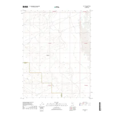
2018 Map of Salt Cave
USGS Topo · Published 2018About this map
Dead Camel Mountains dominate the central landscape of this western Nevada quadrangle, where the terrain rises into distinct high ridges and basins. The topography is defined by the high-desert crests of these mountains, providing a clear view of the natural drainage patterns and elevation changes that have historically channeled movement through this arid corridor. Along the southern edge of the range, Simpson Rd follows a path through the foothills, tracing a historical line of transit across the basin floor. The boundary between Churchill Co and Lyon Co cuts through the map, marking a formal administrative division in an otherwise open and undeveloped landscape. This 2018 survey emphasizes the relief of the mountain range and the singular infrastructure that serves this section of the Great Basin.
Find a feature on this map
4 named features on this map. Tap any name to fly to it.
Don’t see what you’re looking for? This feature index may not catch every label — zoom into the map to look around manually.
Map Details
Editions of this 2018 Salt Cave Map
This is the sole edition of this map. No revisions or reprints were ever made.
Other maps of this area

1891 · Wabuska
USGS Topo · 1:125,000

1894 · Wabuska
USGS Topo · 1:125,000

1908 · Carson Sink
USGS Topo · 1:250,000

1910 · Carson Sink
USGS Topo · 1:250,000

1951 · Weber Reservoir
USGS Topo · 1:62,500

1951 · Fallon
USGS Topo · 1:62,500

1957 · Wabuska
USGS Topo · 1:62,500

1957 · Silver Springs
USGS Topo · 1:62,500

1957 · Reno
USGS Topo · 1:250,000

1959 · Reno
USGS Topo · 1:250,000