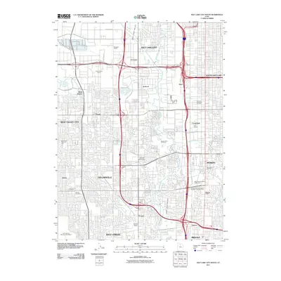
2011 Map of Salt Lake City South
USGS Topo · Published 2011About this map
The Jordan River bisects this densely developed section of the Salt Lake Valley, carving through a landscape of suburban growth and industrial infrastructure. The map documents the extensive transportation corridors of the early 21st century, centered on the complex interchanges at Roper and the grid of major thoroughfares like W 2100 S and Constitution Blvd. This area, encompassing Taylorsville, West Valley City, and Murray, demonstrates the urbanization of former agricultural lands, though significant green spaces like the Taylorsville Memorial Park Cemetery and Meadow Brook Golf Course remain.
Find a feature on this map
52 named features on this map. Tap any name to fly to it.
Don’t see what you’re looking for? This feature index may not catch every label — zoom into the map to look around manually.
Map Details
Editions of this 2011 Salt Lake City South Map
This is the sole edition of this map. No revisions or reprints were ever made.
Other maps of this area

1885 · Salt Lake
USGS Topo · 1:250,000

1885 · Tooele Valley
USGS Topo · 1:250,000

1925 · Ft. Douglas
USGS Topo · 1:125,000

1928 · Ft. Douglas
USGS Topo · 1:125,000

1950 · Fort Douglas
USGS Topo · 1:24,000

1951 · Fort Douglas
USGS Topo · 1:24,000

1951 · Saltair
USGS Topo · 1:24,000

1951 · Salt Lake City South
USGS Topo · 1:24,000

1951 · Midvale
USGS Topo · 1:24,000

1951 · Salt Lake City North
USGS Topo · 1:24,000