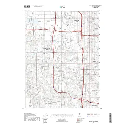
2020 Map of Salt Lake City South
USGS Topo · Published 2020About this map
The Jordan River flows through the heart of this 2020 topographic map, snaking through a densely developed landscape in Salt Lake City and its surrounding suburbs. This portion of the Salt Lake Valley is characterized by an extensive network of man-made waterways like the Surplus Canal and Utah and Salt Lake Canal, reflecting the area's complex irrigation and drainage history. Local residents and genealogists can pinpoint significant landmarks, including the Taylorsville Memorial Park Cem and Redwood Memorial Cem. The map highlights a major regional educational hub, featuring campuses like the Salt Lake Community College - Taylorsville Redwood Campus. Industrial and transportation history is evident through the path of the Union Pacific RR and the South Valley Regional Airport, while recreational areas like Glendale Park and Murray Park provide essential green space.
Find a feature on this map
169 named features on this map. Tap any name to fly to it.
Don’t see what you’re looking for? This feature index may not catch every label — zoom into the map to look around manually.
Map Details
Editions of this 2020 Salt Lake City South Map
This is the sole edition of this map. No revisions or reprints were ever made.
Other maps of this area

1885 · Salt Lake
USGS Topo · 1:250,000

1885 · Tooele Valley
USGS Topo · 1:250,000

1925 · Ft. Douglas
USGS Topo · 1:125,000

1928 · Ft. Douglas
USGS Topo · 1:125,000

1950 · Fort Douglas
USGS Topo · 1:24,000

1951 · Fort Douglas
USGS Topo · 1:24,000

1951 · Saltair
USGS Topo · 1:24,000

1951 · Salt Lake City South
USGS Topo · 1:24,000

1951 · Midvale
USGS Topo · 1:24,000

1951 · Salt Lake City North
USGS Topo · 1:24,000